Wiki · Arcology history · Paper cities
Wiki Arcology history · Paper cities
Paper cities, 1829–1929
Drawings of one structure that would hold a whole social world — Earth publications, not recovered Concordia plans.
Paper cities
This page is Earth history for 2490 Museum / Zoggoling readers. Concordia may hang these plates. It does not become them. Parent: Earth history of arcologies.
Why 2490 still reads these plates
A linear plan, a glass arcade, a charcoal tower with setbacks — each drawing answers a problem that later builders kept meeting: how to put many lives in one envelope without spilling into another suburb. Museum docents can teach the drawing without claiming Odelo traced it. Institutions disagree about influence. This page records the Earth objects.
Fourier’s Phalanstère
Charles Fourier’s Phalanstère (plans circulating in the 1820s–30s; often dated around 1829 in later plates) imagined a symmetrical palace for a fixed community — commonly cited as 1,620 people — with covered glass arcades connecting apartments, dining halls, and workshops. It is an early closed social palace, not a steel megastructure. The arcade is the ancestor image of a climate corridor, not a Concordia HVAC diagram.
Figure reserved
Phalanstère: a social palace with connecting arcades. Earth utopian architecture.

Gillette, The Human Drift (1894)
King Camp Gillette — better remembered for the safety razor — published a utopian socialist manifesto proposing that existing cities be abandoned for one vast, multi-tiered metropolis near the Great Lakes, powered from Niagara. The public-domain plates show hexagonal halls and indoor gathering rooms on a single energy heart. One power source for a whole indoor world is an Earth thought, not a Concordia utilities manual.
Credit: King Camp Gillette, 1894. Public domain. Internet Archive.
Chambless, Roadtown (1910)
Edgar Chambless designed a continuous linear megastructure: houses over a silent railway, a pedestrian promenade on the roof, utilities in the foundation. It is the obscure grandfather of later “city as a line” ideas. It is not NEOM, and it is not a section of Arcology One. Short definition: Glossary · Roadtown.
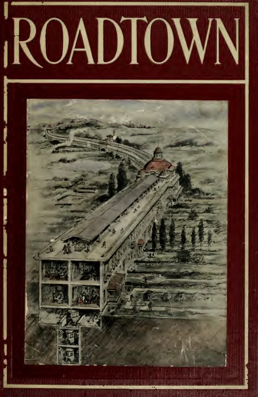
Museum Archive · sample placard voice
The city that wanted to be a line. Chambless, 1910. Earth, before Opening.
Sant’Elia, La Città Nuova (1914)
Antonio Sant’Elia’s Futurist drawings — terraces, external lifts, stacked transit, skybridges — are the visual birth of a look later audiences called megastructure or cyberpunk. He died in 1916; the 1914 sheets are treated as public domain. They teach silhouette and vertical movement. They are not Laser District construction documents.
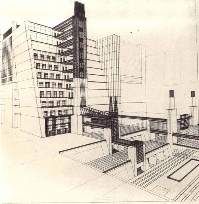
Hablik’s crystalline colonies (proposed / incomplete license)
Wenzel Hablik’s early-1920s crystalline utopias are useful as aesthetic cousins — fantasy or alien silhouettes more than engineering. He died in 1934. Some sheets appear on Commons with a U.S. public-domain claim for pre-1931 publication; later works may still be protected in life+70 countries. If a file’s license line is ambiguous, skip it. Do not scrape museum scans to “complete” the set.
Ferriss, The Metropolis of Tomorrow (1929)
Hugh Ferriss rendered New York’s setback zoning as monumental charcoal: ziggurats, canyon streets, a city imagined as stacked mass rather than a lace of lots. The 1929 book is public domain in the United States. Columbia’s later Ferriss drawings collection is often still in copyright — prefer the published 1929 plates. Short definition: Glossary · Hugh Ferriss.
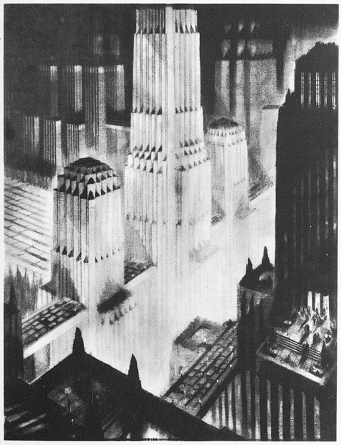
mettomo00ferr. Earth history — not a depiction of Concordia.A 2490 placard can be one sentence: ancestor drawing, not a map of Concordia. Residents may still argue whether the book sat on a founding table. History does not settle that argument.
Zoggoling catalog practice (as Museum scholarship reconstructs it) keeps each plate under its Earth title and year: Phalanstère · The Human Drift · Roadtown · La Città Nuova · The Metropolis of Tomorrow. Influence claims are argued in footnotes; the objects themselves are not rewritten as Concordia blueprints. Gillette’s 1894 Niagara / Great Lakes megacity is sometimes noted beside Concordia’s published continental geography (North America near the U.S.–Canada border) as a rhyme of site logic — never as proof that Opening followed Gillette’s plan.
Read next
Hardware that made the drawings buildable: Machines. Built experiments: Prototypes. Concordia timeline: History.